SERVICE AND PRICING
Service and Pricing
If you are interested in receiving satellite data to provide useful insights into your land for agricultural purposes, then you will first need to register with us for the service.
How to Register
Contact us using the contact form on the website or contact us directly using the email address below.
TerraSat-Analytics <europeservices01@gmail.com>
What we will need from you to register:
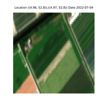
- We need to identify the area(s) of land of interest to you using either the Ordnance Survey grid references or latitude and longitude coordinates.
- We require an email address for correspondence where we will send the links to the data.
- We also need to know whether you want to sign up for a monthly subscription or prefer a one off payment per download.
How the Service Works
Once you have successfully registered with us, we will send you a confirmation email.
We will then send you an email when the next set of data is available. The exact date the data will be available will depend upon the location of your land and when the satellite passes overhead. The Sentinal 2 satellites orbit the UK every 2-3 days and the data is made available by the Copernicus Space Programme approximately a day after capture. Please note if there is high cloud coverage when the satellite passes overhead it may not be possible to extract data of sufficient quality.
If at any time you want us to stop receiving emails from us then all you need to do to unsubscribe from the service is send us an email to request to be removed from the mailing list. We will endeavour to remove you from the mailing list within 24 hours.
If you would like to get a free sample set of data for your land before signing up please let us know and we’ll be happy to help.
Product Pricing
The following payment options are available for you to sign up for the service:
- Pay on demand for the data which is £5 per location for a given date
- A monthly subscription at £20 for a location. Discounts are available for multiple locations.
If you opt for the one off payment per download then the price per download is £5.
We will send you an email link when the data is available. You will need to click the link to purchase and download the data.
If you opt for the monthly subscription then the price per month is £20 per 5 km by 5 km location.
We offer a discount if you purchase more than one square:
- The price per month for 2 x 5 km by 5 km squares is £30.
- The price per month for 3 x 5 km by 5 km squares is £35.
Please contact us if you require more than 3 squares and we will be happy to provide a price.
The month will start from the day after you subscribe and is for one calendar month. So, if you pay on the 4th July then the monthly subscription will run from 5th July until the 4th August inclusively. Throughout the month you will receive emails with a link to download the data. The links to the data will be sent as soon as the data is made available from the Copernicus programme and has been processed by us.
On occasions the data quality may be low if a lot of cloud is experienced throughout the month. If the number of dates images are available is less than 5 we are happy to provide the next month's data for free or offer a proportional discount.
The Data
Regardless of the payment option selected the following data is supplied via download.
The download will include 5 images for each of the image types which are true colour, NDVI, NDMI, GCI & RECI and represent approximately a 5 km by 5 km square identified by the OS grid reference. These will be from the last time the satellite orbited overhead and the date of the orbit will be provided. Note, if there is high cloud coverage on the day that the satellite orbited overhead then data will not be made available.
We will send you an email link when the data is available. The data will be available to download for up to one calendar month. After one month the data will be removed and the link will no longer work.
Data Protection
We do not share you details or email address with any other companies.
All payments are processed using Square and we do not hold any payment details